Document Type : CASE STUDY
Authors
1 Department of Strategic Space Application, National Space Research and Development Agency, Abuja, Nigeria
2 Department of Geosciences, Environment and Spatial Planning, University of Porto, Porto, Portugal
Abstract
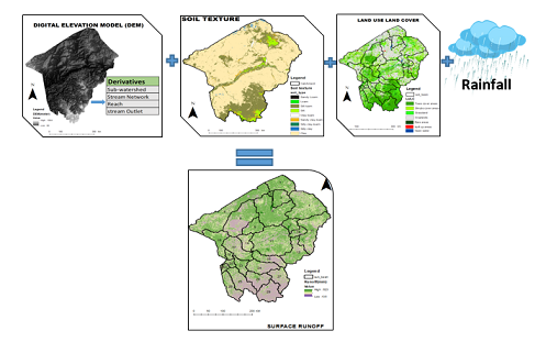
Runoff assessment and estimation is crucial for watershed management as it provides information that is needed to expedite the course of watershed planning and development. The most commonly used model due to its simplicity and versatility in runoff estimation is the soil conservation service curve number developed by the United States Department of Agriculture. The study estimates the surface runoff of Upper Benue watershed using a geospatial based soil conservation service curve number model. Datasets utilized for this purpose are; Rainfall, land use, digitial elevation model and FAO-Soil. The soil and land use data were intersected to create the curve number grid and database. The curve number grid combined with the mean annual rainfall data from 1990 – 2017 was used to estimate runoff. The result revealed that 61.5% of rainfall was direct runoff while 38.5% of the rainfall was retained by tree/plant cover and soil. The average curve number for the normal condition was calculated to be 80.1 while the dry and wet season was 59.6, and 93.2 respectively. The average runoff volume for 27 years was estimated to be 69,887.43mm3. A correlation coefficient of 0.79 was found for the relationship between rainfall and runoff. The research highlights the importance of geospatial technique when integrated with soil conservation service curve number to estimate runoff conditions in Upper Benue Watershed.
Graphical Abstract
Highlights
- Estimation of surface runoff was done using DEM, Soil texture, Land use land cover and rainfall data
- Result of the weighted CN is 80.1 indicating the flooding potential of the upper Benue watershed is high,
- The smaller sub-watersheds with high runoff potential are prone to flash flood
- It was estimated that the average annual runoff of the watershed for 27 years is 452.82mm resulting in the discharge of an estimated 69.887.43 mm3 of water.
Keywords
- Antecedent moisture condition (AMC)
- Digitial elevation model (DEM)
- Harmonized soil group (HSG)
- Runoff
- Soil conservation service curve number (SCS CN)
- Watershed
Main Subjects


Letters to Editor
[1] Letters that include statements of statistics, facts, research, or theories should include appropriate references, although more than three are discouraged.
[2] Letters that are personal attacks on an author rather than thoughtful criticism of the author’s ideas will not be considered for publication.
[3] Letters can be no more than 300 words in length.
[4] Letter writers should include a statement at the beginning of the letter stating that it is being submitted either for publication or not.
[5] Anonymous letters will not be considered.
[6] Letter writers must include their city and state of residence or work.
[7] Letters will be edited for clarity and length.
Send comment about this article